Satellite imagery reveals extensive damage to Iran’s military and nuclear facilities
· 44 views
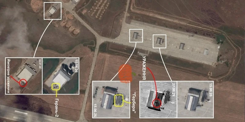
WASHINGTON, D.C. (Terror Monitor) — Planet Labs, a leading satellite imagery provider, has released high-resolution images of multiple military and nuclear sites in Iran, offering new insight into the scale and nature of reported damage.
According to reports, the company has restored access to imagery covering nearly 800 locations in Iran, after access was restricted in March at the request of the U.S. government. The dataset includes more than 250,000 satellite images collected over time.
Defense analysts and international media outlets reviewing the imagery have focused on key sites in Isfahan and Bushehr, highlighting significant damage to several strategic facilities.
Widespread damage in Bushehr
Satellite images reportedly show extensive damage across multiple military installations around the coastal city of Bushehr, with some sites appearing completely destroyed.
According to the military intelligence firm Janes, the affected facilities include military and government buildings, aircraft hangars, ammunition depots, naval repair centers, and missile launch positions. The imagery indicates severe structural damage or total destruction at multiple locations.
Reports suggest that both Iranian government facilities and Islamic Revolutionary Guard Corps (IRGC) sites were among those impacted. Several areas identified on open-source mapping platforms as military zones appear to have suffered near-total destruction of infrastructure.
Isfahan and Natanz sensitive sites
Isfahan province hosts two of Iran’s key nuclear-related facilities in Isfahan city and Natanz. The satellite imagery analysis indicates damage to multiple military installations in the region.
Janes reported that at the Shikari Heshtham Air Base, several ammunition storage units were damaged. In southern Isfahan, more than 60 structures at one military installation were reportedly damaged or destroyed.
Additionally, around a dozen buildings were affected at another military facility near Baharestan.
According to analysts, the satellite imagery provides a clearer understanding of strike patterns, target selection, and the extent of damage to military infrastructure across Iran.
Related Articles

Iran warns of immediate response to US interference in Strait of Hormuz
Iran’s military warned that any U.S. interference in the Strait of Hormuz would receive a “decisive and immediate response,” saying vessels must follow designated Iranian navigation routes or risk facing a swift and severe reaction.
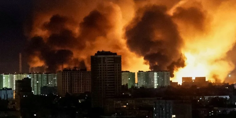
Russian missile and drone attack on Ukraine: 20 killed, 100 injured
Russia launched a major overnight wave of missile and drone strikes on Ukraine’s capital Kyiv, killing at least 20 people and injuring around 100, Ukrainian officials said. The attacks, involving ballistic and cruise missiles alongside combat drones, caused widespread damage to residential buildings and civilian infrastructure, while rescue operations continued in several districts of the city.

Iran: Missile and Drone Program Is a “Red Line” of National Security
Iran’s Acting Defense Minister Majid Ibn al-Ridha has said that the country’s missile and drone programs are a “red line” of national security and will not be open to any negotiations. He added that Iran will continue to strengthen its defense capabilities using domestic resources and technology.

Israeli Minister Says Gaza Control to Expand to 100%
Israeli Energy and Infrastructure Minister Eli Cohen has said that Israel’s control over Gaza will continue to expand until it reaches full control of the territory. He stated that military operations are being intensified and claimed that Israel already controls around 70% of Gaza, with plans to extend this further.